The Met Office has issued a fresh weather warning for wind over the weekend, as areas across the UK struggle with extreme flooding following heavy rainfall this week.
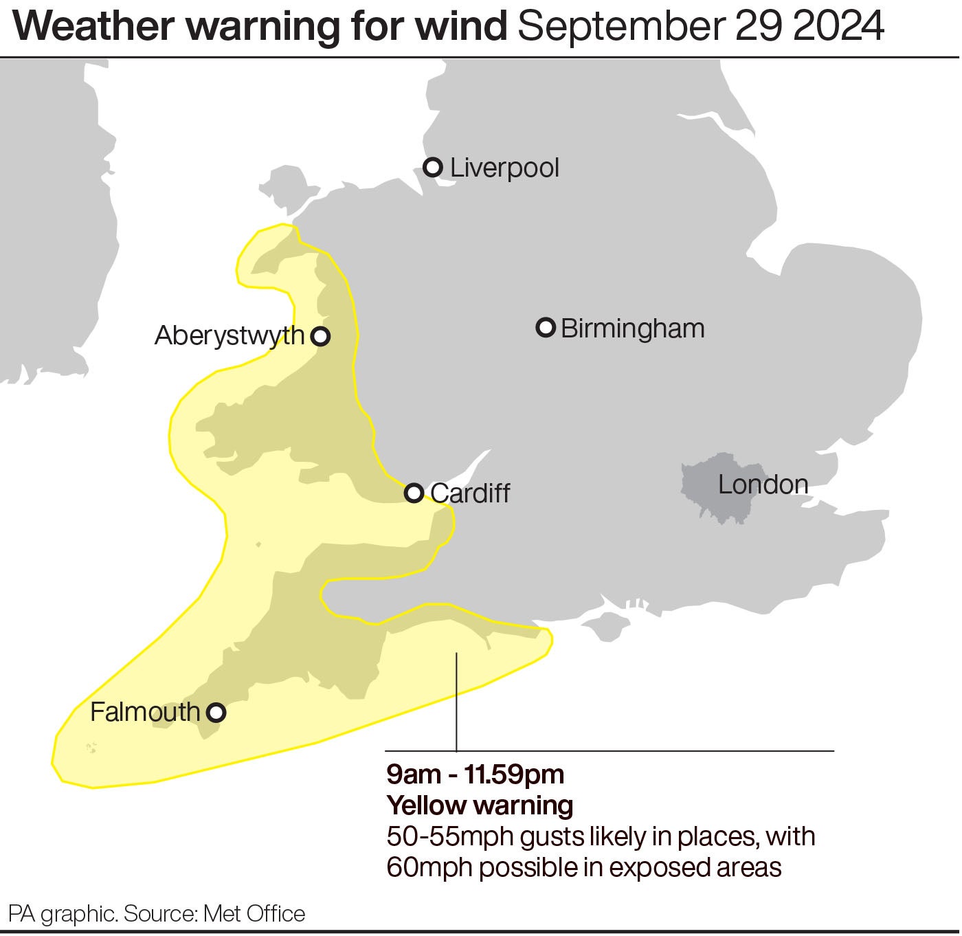
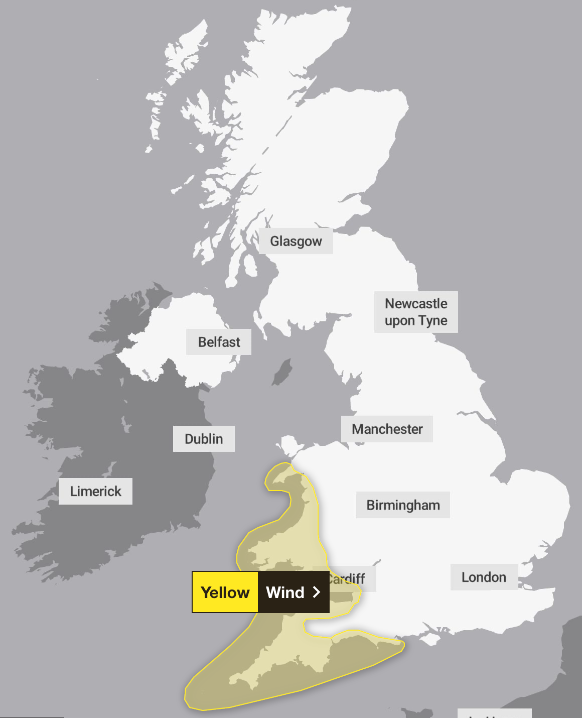
Areas of south west England and Wales will be blasted by winds of up to 60mph on Sunday, as a yellow weather warning comes into place from 9am until 11:59pm,
The forecaster warned that coastal routes will be affected by large waves while power cuts and delays to transportation will likely be seen.
“A Yellow warning for wind has been issued for much of Sunday across portions of southwest England and south and west Wales, where gusts could reach or even exceed 60 mph on exposed coasts, and 50-55 mph more widely,” Met Office Deputy Chief Meteorologist Dan Holley said.
It comes as motorists and rail passengers faced travel chaos on Friday morning as overnight heavy rain left travellers stranded.
Drivers had to be rescued from their cars on the M5 overnight following flooding as parts of the route remain closed off this morning.
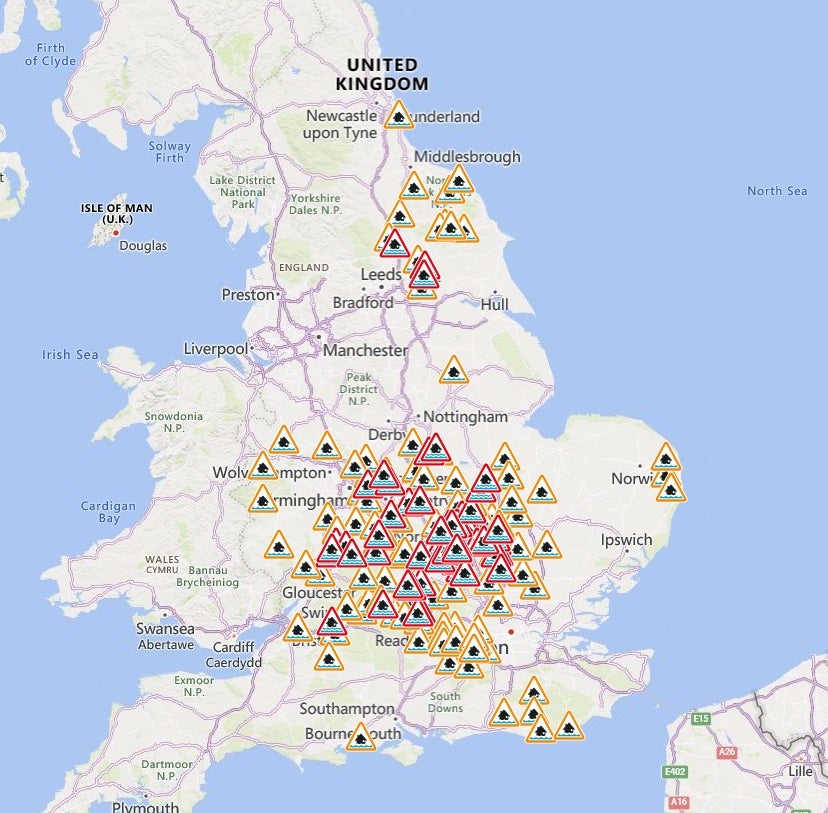
As of 11:15am, the Environment Agency had 62 flood warnings in place across England, meaning flooding is expected, and 117 flood alerts, meaning flooding is possible.
Flood warnings still in place
Despite a brief respite in the tottential downpours on Friday and Saturday, there are still 59 flood warnings in place across England, as of 3.30pm on Friday.
Many appear in the east Midlands where there was an amber warning for flooding last night.

Eel washed up
Not what you expect on a round of golf – but at Brent Valley Golf Course, players spotted this eel in lying water off the fairway.
Where is Sunday’s weather warning for?
The Met Office has issued a further yellow weather warning of strong winds which may cause disruption across the south west of England and Wales on Sunday.
Winds will strengthen from west to east during Sunday, with gusts of 50-55 mph likely in places, exceeding 60mph in the most exposed areas.
Winds will gradually ease across Wales and inland parts of south west England through Sunday evening and night, but it may remain fairly windy along some coasts of southern and south-western England during Sunday night.

Will it stop raining next week?
The UK has seen a huge amount of rainfall in the past week, marking a sharp end to summer.
But will it dry up next week at all? The Met Office says potentially.
The forecaster said that while Monday will remain wet, it should become somewhat drier and brighter more widely around midweek. However, there are signals for the potential of further wet and windy weather towards the end of next week.

Five day forecast
Morning heavy rain clearing central and southern parts of the UK. Then a bright day for many, with sunny spells and scattered showers. A colder feeling day than of late, especially in the south with a brisk northerly wind.
Showers tending to become confined to the northwest through the evening and overnight. Many areas dry, with prolonged clear spells. A chilly night to come, with a patchy frost possible.
Most places dry with sunny spells. A scattering of showers across northwestern parts, most frequent across Scotland. A rather cold feeling day for many with winds easing.
Outlook for Sunday to Tuesday:
Wet and windy weather slowly moving northeastwards across the UK through Sunday and into Monday, mainly affecting England and Wales. Gradually turning drier and brighter on Tuesday from the west.
More from the Met Office on new weather warning
Speaking about the warnings of strong winds to hit the UK over the weekend, Met Office Deputy Chief Meteorologist Dan Holley said: “After a drier interlude for many on Friday, Saturday and early Sunday, attention shifts to a deep area of low pressure to the southwest which will bring rain and strong winds to parts of the UK, potentially impactful for some.
“A Yellow warning for wind has been issued for much of Sunday across portions of southwest England and south and west Wales, where gusts could reach or even exceed 60 mph on exposed coasts, and 50-55 mph more widely. This system will gradually track eastwards through Sunday and into Monday and will bring another spell of wet weather fairly widely across the UK.
“We’re continuing to monitor the rainfall with this system, as rain falling on saturated ground in flood-hit areas has the potential to cause further impacts. Stay up to date with the latest forecast as further warnings could be issued in the coming days.”

Met Office issue new weather warning for weekend
The Met Office has issued a fresh weather warning for wind over the weekend as many continue to struggle with flooding.
Areas of south west England and Wales will be blasted by winds of up to 60mph on Sunday as a yellow weather warning is set to come into place at 9am and remain until 11:59pm.
The forecasters warned that coastal routes will likely be affected by large waves while power cuts and delays to transportation will be seen.
“Winds will strengthen from west to east during Sunday, with gusts of 50-55 mph likely in places, especially near coasts and over/to the west of high ground, perhaps exceeding 60 mph in the most exposed areas,” the Met Office said.
“This will be accompanied by outbreaks of rain, heavy at times, which could lead to some surface water and spray. Winds will gradually ease across Wales and inland parts of southwest England through Sunday evening and night, but it may remain fairly windy along some coasts of southern and southwestern England during Sunday night.”

Update given on A421 closure
Drivers have been reminded to avoid the area around the closed A421 as work continues to reopen the route following flooding.
The A421 in Bedfordshire was expected to remain closed in both directions on Friday between the A6 Bedford and M1 junction 13 near Marston Moretaine, as floodwater continued to be pumped clear from the junction.
National Highways said: “We are working around the clock to tackle the significant rainfall on the A421. We understand people are curious but request that members of the public continue to support us by staying away from the area so our work to resolve the issue can continue to progress at pace.”
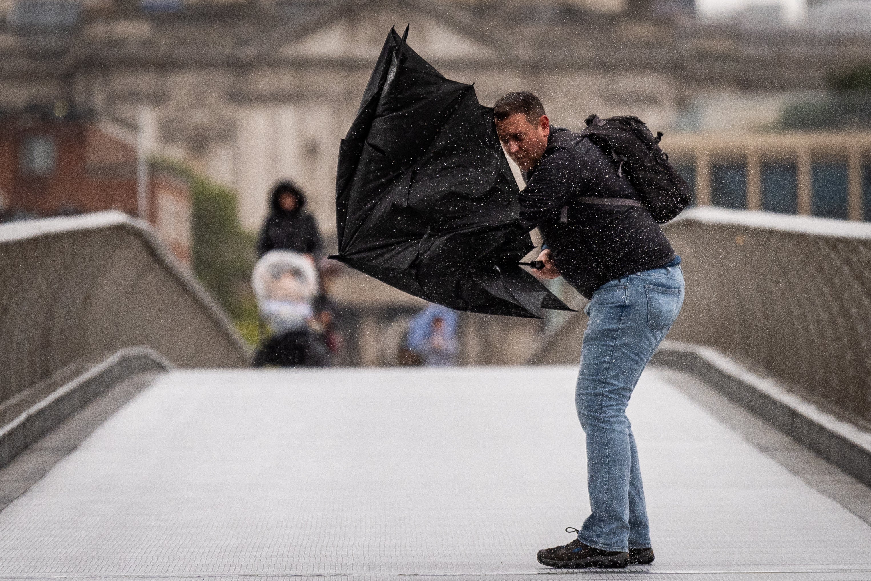
Londoners battle heavy rain


62 flood warnings and 117 flood alerts now in place, Environment Agency say
As of 11:15am, the Environment Agency had 62 flood warnings in place across England, meaning flooding is expected, and 117 flood alerts, meaning flooding is possible.
This is slightly less than the 121 flood alerts and 66 flood warnings seen earlier this morning.
We will continue to update the number of flood warnings throughout the day.
Source: independent.co.uk


